Introduction
If you haven’t been to the stadium formerly known as Turner Field since the Atlanta Braves played their last game there in 2016, you might be shocked by a visit to the area today.
Stand at the corner of Georgia Avenue and Hank Aaron Drive, just shy of a mile south from Atlanta’s gold-domed state capitol, and look west at what is now Georgia State University’s football stadium. Across the street, what was once hundreds of spaces of surface parking reserved for Delta SkyMiles Medallion members has been replaced by a massive student housing complex.
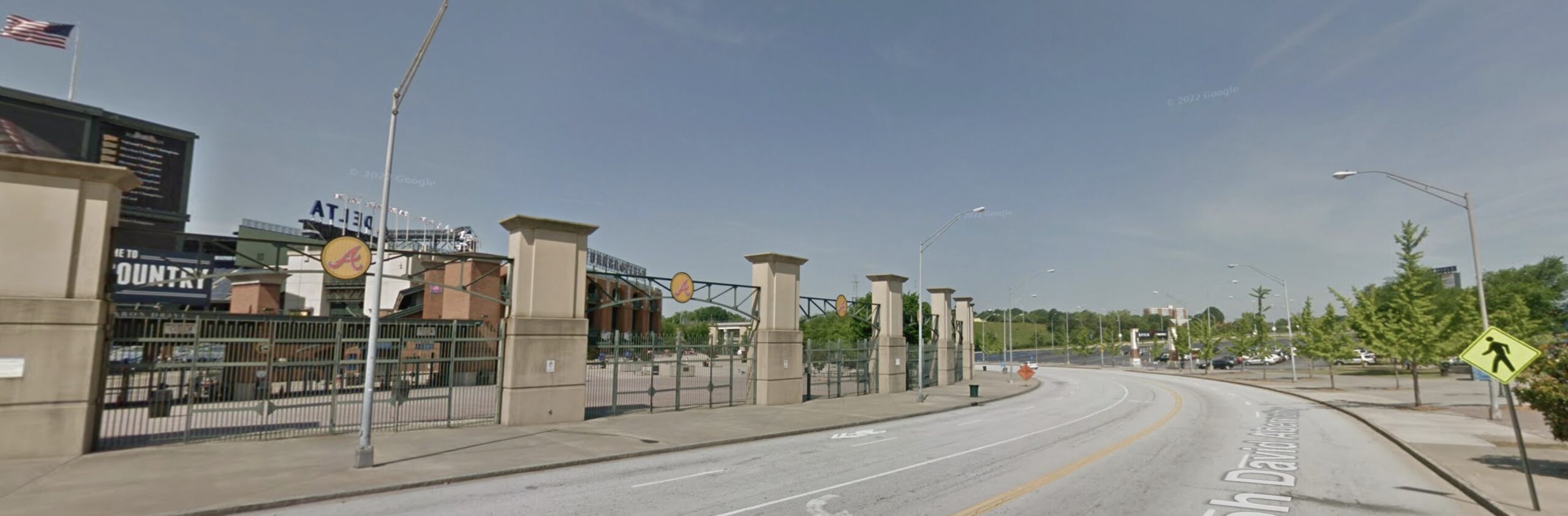
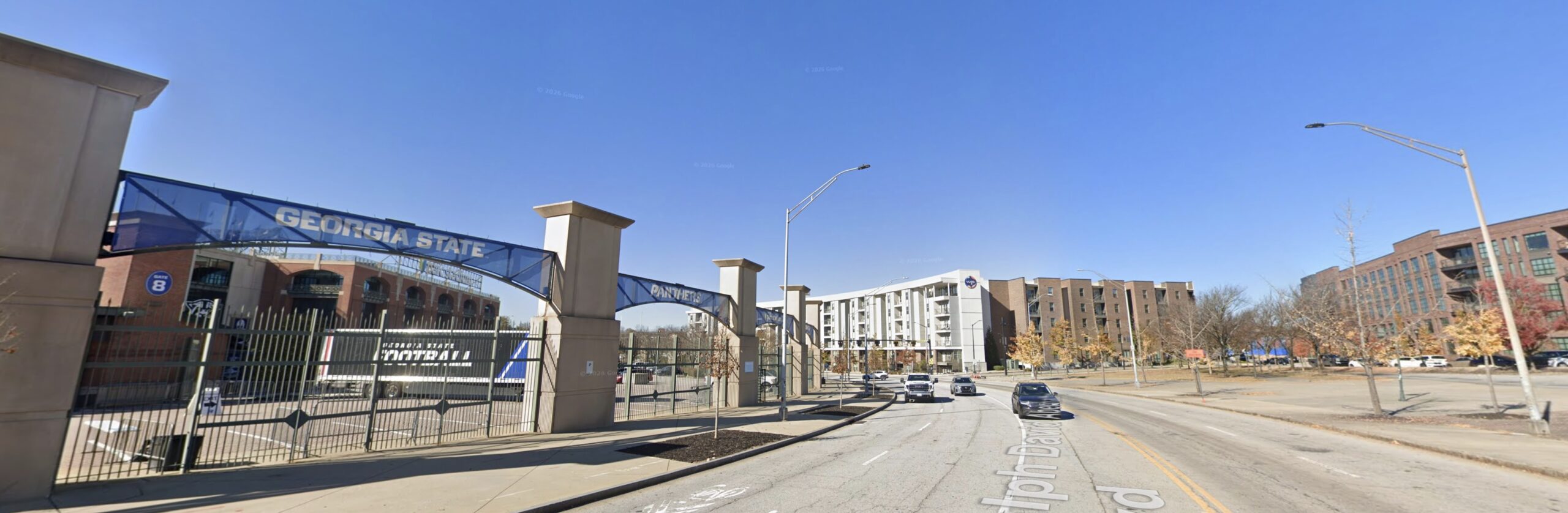
DRAG SLIDER to compare 2014 to 2025
Look east toward several blocks of low-slung mid-century brick buildings. When the Braves left the neighborhood, Georgia Avenue looked like one of those abandoned small-town main streets, its structures left to rot and its storefronts covered with plywood. Today you’ll see a thriving business district, a charming mix of adaptive reuse and new construction.
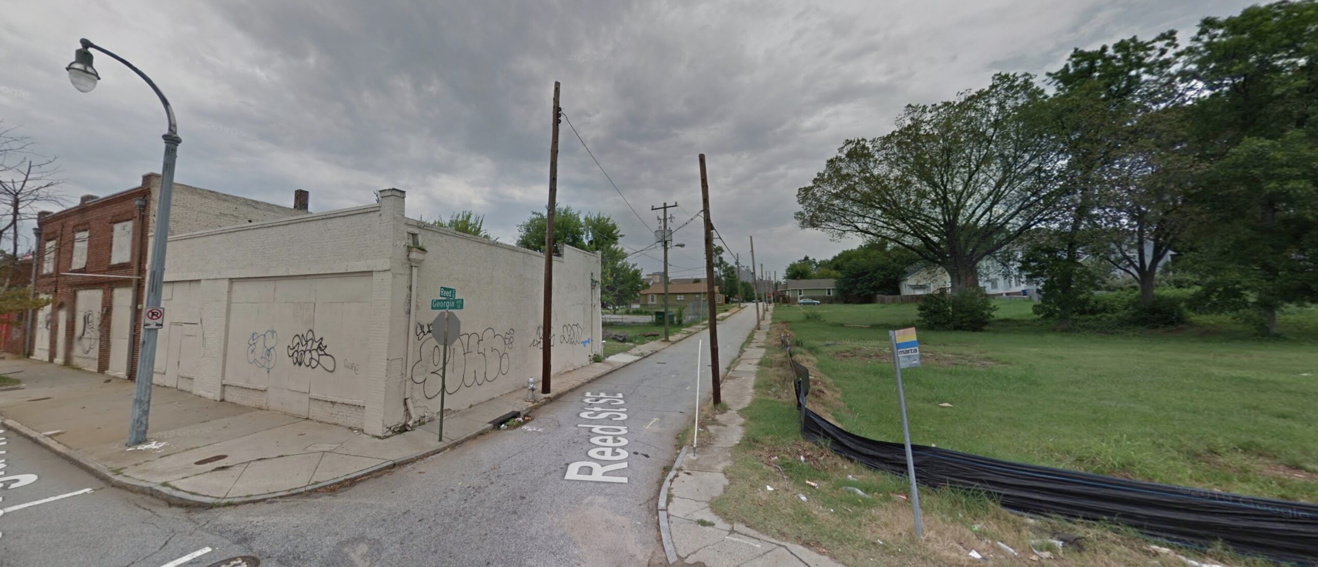
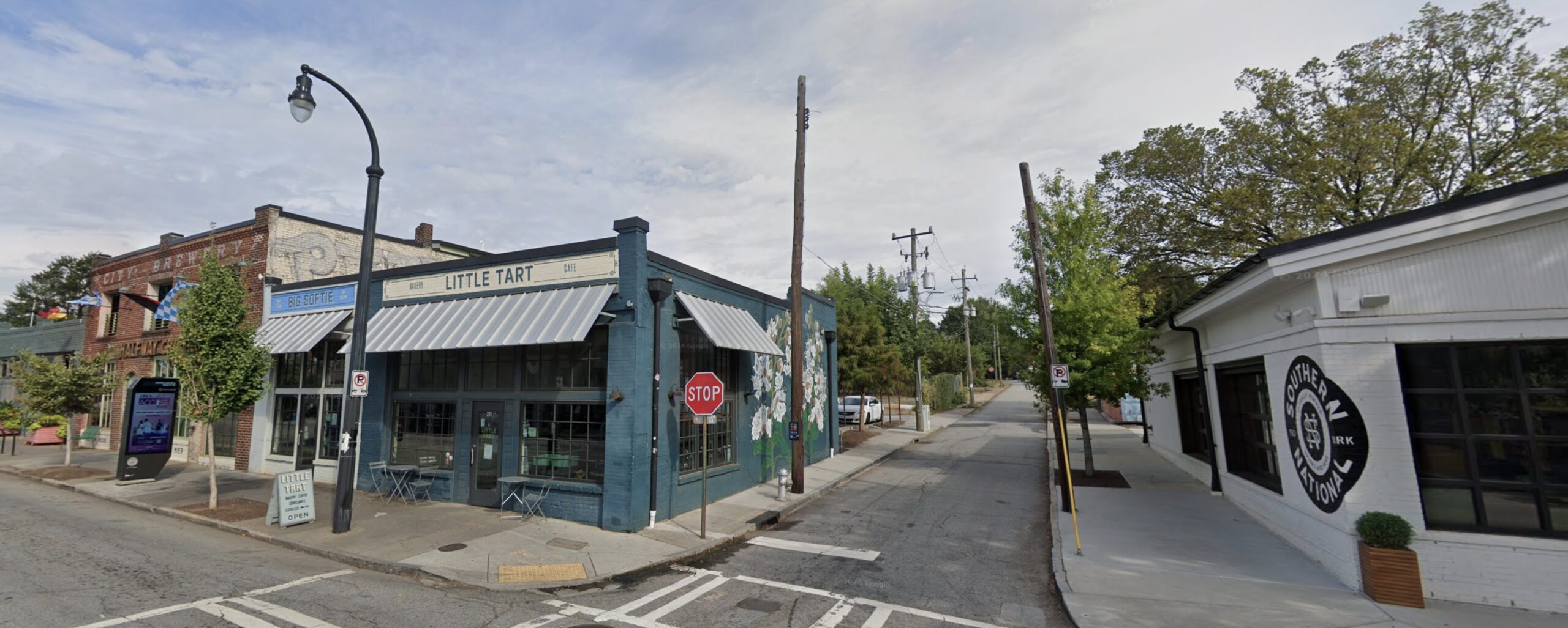
DRAG SLIDER to compare 2012 to 2024
New development has brought renewed attention to Georgia Avenue, as well as to Summerhill, the surrounding neighborhood. One of the oldest Black neighborhoods in Atlanta, Summerhill has undergone multiple sweeping metamorphoses over the past decades, from which Georgia Avenue was not spared. Before World War II, Georgia Avenue was lined with grocery markets and restaurants, shoe repair shops and convenience stores, butchers and bakers and ice cream makers, even a movie theater. Its businesses also served the Jewish, Greek, and Syrian communities who lived nearby; these streets were home to much of the city’s immigrant population at the time.
Georgia Avenue’s deterioration in the second half of the twentieth century reflected Summerhill’s fortunes. It might be said that the gradual disappearance of commerce along Georgia Avenue played a part in hastening Summerhill’s decline. Today, the crisis is gentrification. As affluent Atlantans gravitate toward new luxury development in intown neighborhoods like Summerhill and GSU expands its local footprint, rising rents and property values are pushing out longtime residents. The restaurants and cafes now open on and around Georgia Avenue – an assortment of foodie, hipster, and healthy fast-casual establishments – suggest the clientele this restored Georgia Avenue aspires to serve. There’s even a Publix Super Market, in what was was a food desert for decades.
Neighborhood change is a fact of city life. But the forces driving these changes are hard to discern, especially when parts of a streetscape have been demolished and erased. How can we trace the transformation of Summerhill, and Georgia Avenue, if we can only see what’s there now?
If we want to make sense of what happened to Summerhill – and to neighborhoods like it in cities all over the country – we can start by thinking of Georgia Avenue’s streetscape as a palimpsest, a surface that has been written upon, erased, and written upon again and again. The imprints of past texts remain, though only faintly. The history of Georgia Avenue, and of the people who were once there, is all around you – and it’s legible if you know how to look.