Separate & Unequal
Both Summerhill and the Southside were primarily residential. But they were also institutionally robust, filled with schools, houses of worship, and other spaces for public use. Catherine Robinson, who grew up in Summerhill, recalled that church and school were the anchor of her community. For thousands of Atlantans who lived in Summerhill and nearby Black neighborhoods, E.P. Johnson School and a dozen churches created space and resources for education, spiritual uplift, play, and community organizing.
Click “Play” arrow to hear a short interview with Catherine Robinson
The same was true for white residents on the other side of Capitol Avenue. But white Atlantans’ privilege and advantage, in comparison to their Black neighbors, shaped every aspect of the city. By 1930, white-only public schools on the Southside and on Summerhill’s edges outnumbered Black schools by nine to one. One of the white schools was named after Hoke Smith, the Georgia governor responsible for disenfranchising Black voters in 1908.
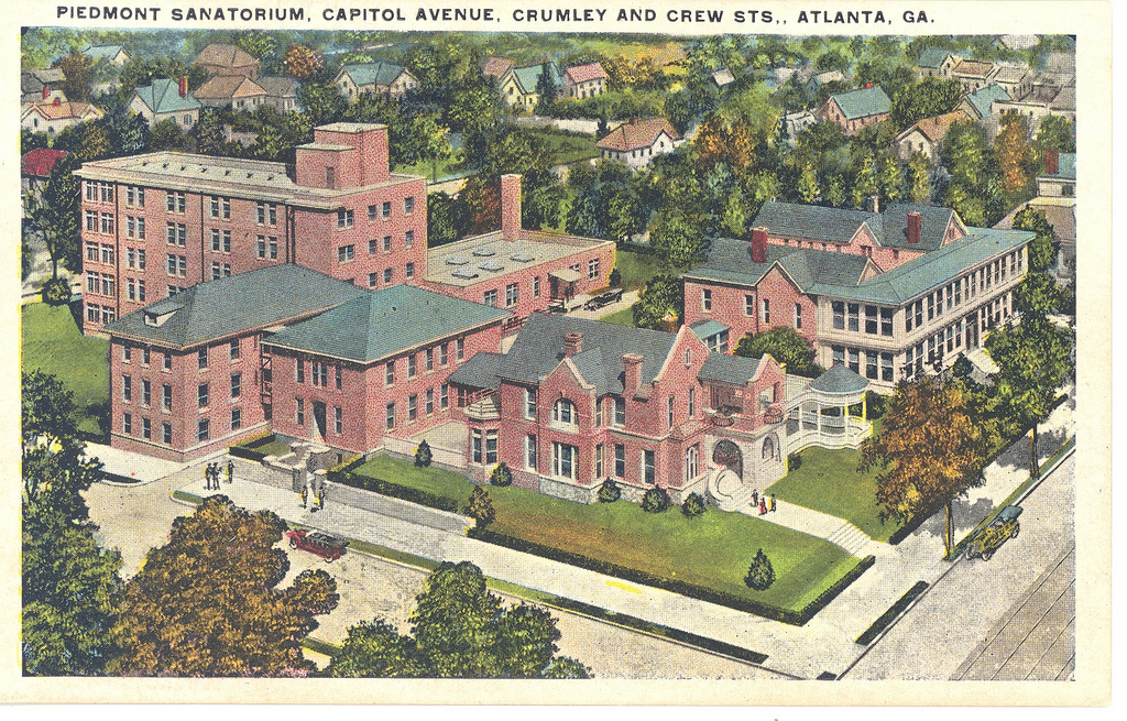
Schools weren’t the only local institutions that refused African Americans. Piedmont Hospital, founded in 1904, grew to encompass an entire block at Capitol and Crumley. Despite its proximity to Summerhill, the hospital did not accept Black patients.
Postcard of Piedmont Sanatorium, c.1920s
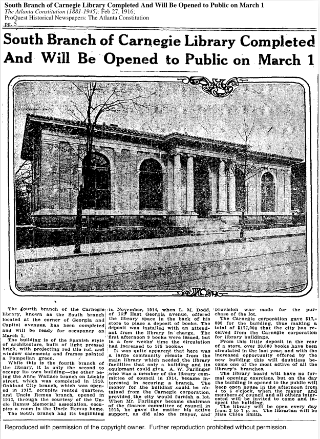
And the Southside branch of the Carnegie Library, built in 1916 at the corner of Georgia and Capitol Avenues, did not welcome Black patrons until the 1960s.
Headline and photo from Atlanta Constitution, 1916
Inequality between Black and white residents was evident in the streets themselves. By 1910, every street on the Southside had been paved, while many of Summerhill’s roads remained unpaved decades into the twentieth century. White Southsiders further prevailed upon the City Council to regrade and repave Georgia Avenue, then a white residential street, so it might serve as a more pleasant and efficient artery moving people from Grant Park to the West End. As Atlanta built out its streetcar network, Georgia Avenue became one of only two east-west lines serving the city’s southeast quadrant. Additional streetcars on four Southside streets – Capitol, Washington, Central, and Pryor – connected residents to the city’s political and economic center. Summerhill’s residents enjoyed no such services in their neighborhood, and had to walk several blocks, or transfer streetcars, to travel by public conveyance to other parts of the city.
This 1924 urban planning map map gives a general indication of the racial makeup of the neighborhoods surrounding Georgia Avenue, and all over Atlanta. Though it fails to indicate the presence of African Americans in the Southside neighborhood, it shows white residents along Summerhill’s main east-west streets: Fair Street (Memorial Drive today) to the north; Georgia Avenue in the middle; and Atlanta Avenue at the neighborhood’s southern border.
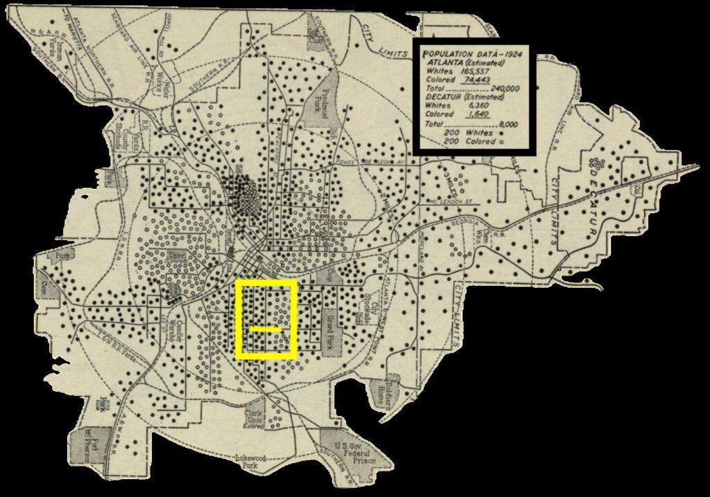
Summerhill and Southside neighborhoods indicated by yellow box; Georgia Avenue is the yellow line
Click here to see this map as an interactive overlay on a current street map (courtesy of GSU Library’s Digital Collections)