Two Neighborhoods
Georgia Avenue at the Beginning of the 20th Century

Today, the Summerhill neighborhood is almost a square, half a mile from end to end.
But at the beginning of the twentieth century, this area was regarded as two different neighborhoods.
These neighborhoods were defined, as was much of Atlanta’s residential geography, by race.
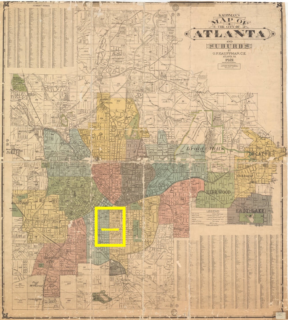
Map of Atlanta and Suburbs, 1921
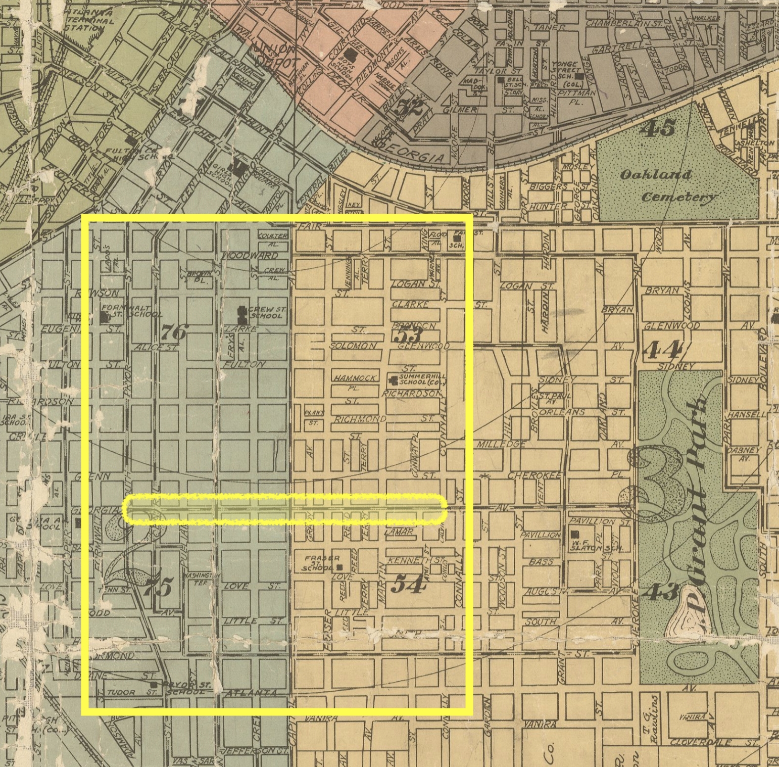
Capitol Avenue (known today as Hank Aaron Drive), a major streetcar and traffic thoroughfare running south from downtown, separated the second and third wards of the city. It served as the dividing line between the two neighborhoods.
The two neighborhoods are outlined here by a yellow square. Georgia Avenue, circled in yellow, ran through both neighborhoods.
Closeup of Map of Atlanta and Suburbs, 1921